ALGO Traffic
Overview
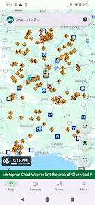
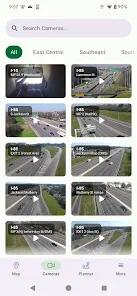
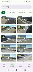
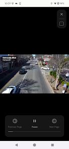
The ALGO Traffic application is a specialized regional transit utility developed by the Center for Advanced Public Safety (CAPS) at the University of Alabama, under the sponsorship of the Alabama Department of Transportation (ALDOT) and the Alabama Law Enforcement Agency (ALEA). Designed specifically for travelers within the state of Alabama, the app provides direct, unmediated access to the state's official traffic infrastructure data, including live camera feeds, digital message sign (DMS) readouts, and real-time incident reports. Currently, the platform provides deep support for the major metropolitan regions of Birmingham, Huntsville, Mobile, Montgomery, and Tuscaloosa.
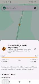
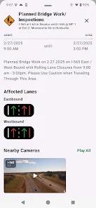
An insightful evaluation of ALGO Traffic reveals its unique positioning as an "authoritative" source of data. Unlike crowdsourced applications that rely on user-reported hazards, ALGO Traffic delivers information directly from the state's traffic management centers, ensuring 100% accuracy for official road closures, construction zones, and lane-specific incidents. The app includes a dedicated "Driving Mode" that provides audible alerts for upcoming events on a user's route, promoting a heads-up navigation experience that is essential for driver safety. Furthermore, it integrates National Weather Service (NWS) alerts, ensuring that drivers are aware of severe weather patterns that could impact interstate safety.
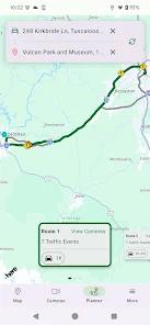
Technically, ALGO Traffic has implemented advanced digital protection measures for its camera playback to maintain high service availability during peak traffic periods or weather emergencies. The app allows users to create personalized profiles at this app, enabling them to save specific daily commute routes and receive proactive push notifications or email alerts for their unique travel paths. While it is a state-specific tool, its integration of high-level government data provides a level of detail—such as exactly which side of the road an accident is located—that is often missing from national navigation platforms.
Pros & Cons
Direct access to the comprehensive network of official ALDOT live traffic cameras across Alabama.
Highly reliable and accurate information on road incidents and construction directly from state authorities.
Customizable user profiles allow for personalized alerts and notifications for specific daily commutes.
Audible alerts in "Driving Mode" keep the driver informed of upcoming hazards without needing to look at the device.
Integration with National Weather Service (NWS) alerts provides critical safety data during severe weather events.
Provides granular detail on lane-specific incidents, which is vital for heavy-vehicle operators.
- ✕
Currently lacks support for Android Auto, which limits its utility for users with integrated car infotainment systems.
- ✕
Geographically limited to the state of Alabama, making it a niche tool for regional residents or visitors.
- ✕
Setting up specific routes for daily alerts can be "tedious" compared to more automated platforms.
Download
 Get it on Google Play
  Get it on App Store
 FAQs
Can I see the traffic cameras without an account?
Yes, you can toggle the map layers to see all available cameras without having to log in or create a profile.
What are "DMS readouts"?
These are the digital displays found on interstates; the app shows exactly what is currently written on them (e.g., "Left Lane Closed 2 Miles").
Is the information updated 24/7?
Yes, the data is pulled in real-time from the ALDOT and ALEA traffic management centers which operate continuously.
Does the app provide alternate routes like Google Maps?
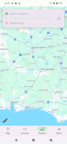
While it focuses on traffic monitoring, its trip planner helps users "know before they go" by showing current congestion levels.
Which cities are fully supported?
Birmingham, Huntsville, Mobile, Montgomery, and Tuscaloosa are currently supported, with more areas planned.
Hot Reviews
Daily drivers between Alabama's major hubs cite the camera access as the single most helpful feature for deciding whether to take an alternate route.
Reviewers appreciate that the data comes directly from ALDOT, noting it is far more reliable for road closures than other mapping apps.
A major recurring piece of feedback is the desire for Android Auto compatibility to make the app easier and safer to use while driving.